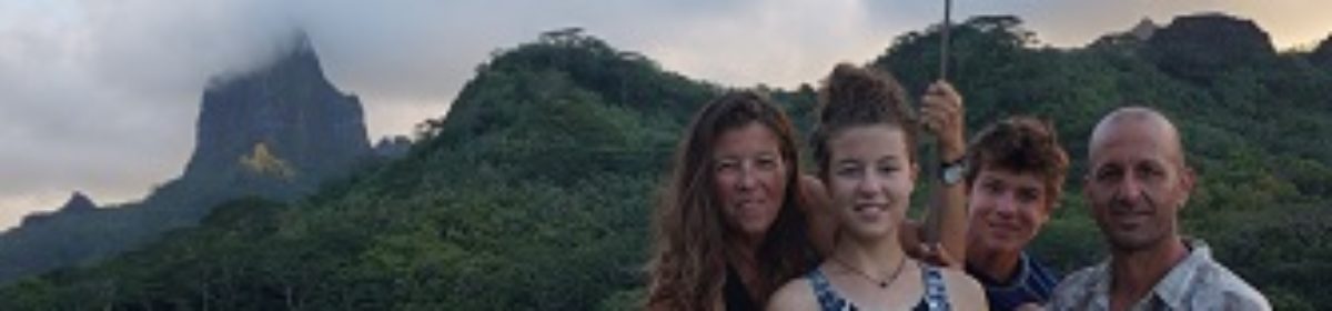
We arrived at the beautiful Island of Hauhine two days ago after a mild 2.5 day passage from the Tuamotuan atoll of Toau. I’m sitting in the town hall in the village of Haapu where we have found wifi. Here are a few more photos from the Tuamotu.
We continue to feel ridiculously lucky to be here and to be in touch with you.
Last shot in the Marquesas.Arlo became an enthusiastic and then accomplished spear fisherman in the the Tuamotu. Here he hunts reef fish from the side of the boat.
The leeward side of an atoll (here, Tahanea) often has very little land visible above the water. You can just barely see a little surf hitting the reef top in this photo.
The windward side of every Pacific Island we’ve been on is strewn with plastic washed ashore. Toothbrushes, shoes, polypropylene rope, and endless bottles and bottle caps .So much beauty underwater. This is the top of a “bommie” that rises up from 70′ of water, a column of life in the middle of an atoll lagoon.Taking underwater photos is tricky, but the swimming is great. Both Arlo and Alma easily free dive to 25′ to see fish and coral. Neither is worried when sharks swim nearby. We’re not in Alameda anymore, Toto.wah?More treasures.Typical motu construction.Life in the Tuamotu–Kauehi VillageTypical boat lift, Rotoava Village, FakaravaEven the five dollar bills are beautiful.Alma and a cruising friend.Arlo, always happy to be able to run again.
On the shelf in the magasin, Kauehi Village
So many roofs are woven palm fronds. This is looking up inside a house.
Picking coconuts, opening coconuts. With friends.
The upright sticks are pieces of rebar that encircle the chambers of a fish weir. Arlo and Jason helped build a new chamber. Not sure if the coral enjoyed it.Finally.With new friends, Anse Amyot.Life on the boat. Rainy day activities.Life on Debonair–rainy day activities.Life on the boat. Rainy day projects.Life on the boat. Alma touches the radio antenna to the backstay for better reception.Getting ready for breakfast.Project ashore.Birth day.Polynesian francs and the operculum (opercula?) that cover the opening of snail shells.Sunset at sea, on the way to the Society Islands.
It is a good thing that everybody else was huddled belowdecks on their boats as we ran out in our underwear to plug in the water catchment hoses during the tropical rain squall. Because we only carry a limited amount of water, we try top up our tanks whenever it rains. In fact, on Debonair, all of our consumable resources are limited. In addition to water, we carefully manage our supply of propane, food, diesel, electricity, and other stores.
Everybody who goes cruising on a small sailboat has to make choices and compromises about how much of what to bring, and everybody makes different choices based on what they want most. Some cruising boats have lots of solar and wind generators, watermakers and powerful dinghy engines, and flat screen TVs. Some boats have no oven or fridge. Those are the ends of the spectrum, and we are probably somewhere in the middle.
WATER
Probably the most critical of our resources, and therefore the one that we conserve the most, is water. We carry 140 gallons in four tanks. We don’t have a watermaker, so we only use freshwater for drinking, cooking and brushing teeth. Our rainwater catchment system directs all the water that hits our mainsail and cabin top into our tanks.
Rainwater flows from our cabin top collection basin.Rainwater flowing onto our tanks.
If we have spare rainwater that we caught in jerry cans or buckets we use it for washing clothes and showering, although the latter is not always a priority because of daily swimming. With all our normal conservation techniques, the four of us use about three gallons a day. At that rate, we have enough water to last us 45 days. Aside from rain, our other way of refilling water tanks is by filling jerry cans ashore and then siphoning the water into our tanks. We can also fill up when we are in marinas, but we haven’t done that since San Diego. For those of you who worry about us, know that we also carry an emergency hand operated watermaker that can produce six gallons per day.
PROPANE
We have two twenty pound propane tanks aboard–each tank looks like the one you have for your barbeque except it has side-mount brackets so they can be installed horizontally on deck under a special cover. Each one lasts us a month and a half. We’re careful with propane too. For example, here in French Polynesia, when my mom bakes bread (about once every third day), we always put something else in the oven then too. With three months of propane, we have a relatively long cruising range compared with other boats of our size. Here in French Polynesia, we have been filling with butane which works equally well for our stove.
FOOD (The Best Supply Aboard)
I drew this map of our lockers onboard.
Back in Alameda, we loaded five full minivans worth of food on board. At the time, that was enough food for four people for five months. Then in Mexico, preparing for the crossing, we filled the taxi driver’s whole trunk, not even counting the 220 green bananas that we bought from the local banana farmer. Despite some reprovisioning along the way and some fishing success, after the Pacific crossing, the Marquesas, and now especially in the desert of the Tuamotus, we are probably down to about two or three months worth of food. As we use up different items, we mark them off in the logbook, with a map of the boat’s lockers and a number and letter for each locker (e.g. one can of tuna from S7). When we arrive in the Society Islands, we will do a big restock. I can’t wait for the subsidized sardines again. Oh yeah, and the fruit and vegetables too.
DIESEL
Debonair has a 75 horsepower diesel engine, and we carry 140 gallons of diesel. At 2200 RPMs, our regular speed, the engine burns about one gallon of diesel per hour, and we make about six knots of speed. At that rate, we have a range of 840 nautical miles. (One NM is equal to one minute of latitude and 1.12 statute miles.) Although we carry a lot of fuel, we try to conserve it. We don’t run our engine while in harbor for generating electricity; we just run it when we need it to move the boat. When we have gone a while without refueling or are about to leave on a crossing, we need to refuel. In the States and in Mexico, we could usually fuel up at a fuel dock with a hose, but in the South Pacific, we usually have to refill by taking jerry cans to a gas station (different jerry cans than we use for water, of course!).
ELECTRICITY
Our electrical panel shows battery voltage and electrical draw (in amps).
When we run the engine, the alternator charges the two 500 amp hour batteries beneath the sole (floor). When we first get settled in an anchorage and shut off the engine, we will usually be all charged up from the engine time. The batteries will then last easily for a week, but we can stretch it to two weeks before we need to charge again. We are extremely careful with our electricity usage on board. We only use the absolute minimum cabin lights, and we prioritize running the navigation computer and our running lights at night (red on the port bow, green on starboard, and a white stern light). Our less prioritized electricity usage includes other computers, our VHF radio, a fan, charging devices and running the fridge, which we only do when we have enough power. Aside from running the engine, our only other way to charge is two small solar panels. [Editor’s note: we eventually got two more panels . . . and oh the refrigeration!]
OTHER STORES
Our line locker contains loads of spare rope. We hang it so it doesn’t get snarled.
Apart from all the other categories of consumable resources already mentioned, we have a lot of other stores on board. These can be split into two categories: spares and materials. Spares are things like light bulbs, float switches for our bilge pump, fuel filters, rubber impellers for the engine cooling pump, spare parts for the head, the galley pumps, the windvane, etc. Materials includes things like bolts, screws, lengths of rope, plywood, planks, and shock cord. If we brought spares for everything, we would sink the boat, so we chose carefully. We have had to buy some spares along the way and get a new relay switch for the engine shipped to the Marquesas, no easy task, but besides that, we have done pretty well on our compromises. Among many other items, we had the rope we needed to replace worn rigging, and the hardware we needed to make a set screw to fix the windlass, and even when our snorkel mask strap broke, we fixed it with some inner tube material.
It might be fun to be on a megayacht for a two-week charter and have all the luxuries of wifi and high-capacity watermakers, but that really doesn’t give you the full experience of cruising. I am also glad that we aren’t cruising with even simpler supplies than what we have now. We would always have to be stopping in at ports and cities to resupply. We will soon be heading to the Society Islands on a three day passage, where once again we will be in the land of plenty, but it’s good to know that we can live off what we have got.
There’s treasure in the Tuamotu. If you are already in the Tahanea Atoll and just want to get to the point, then skip to the end of this post where there are photos of the treasure map we created. But I hope you’ll stick around to read the rest of the post!
Tahanea Atoll is a great first stop in the Tuamotu. It’s a beautiful, uninhabited atoll, and it’s also a nature preserve. This means that there are many birds and lots of coral reefs to snorkel. It’s also upwind of many of the atolls that cruisers go to. I hope that you visit Tahanea and find our treasure.
A first sketch of the motu with distances and directions marked.
The Mapping of the Motu
Making the final map.
Kids from three boats, Alma, Arlo, Anna, Sophia and Teo, went ashore to map a previously unmapped motu. First we all ran around the little motu to get a sense of it. When we got back to the beach where we had come ashore, our parents gave us the tools that we would need: a hand bearing compass, a clipboard, and a 100 meter tape measure. We measured our walking paces to measure distances. To map the island, we walked from point to point measuring in various directions on the hand bearing compass, to find the proportions of the motu. Next, we plotted the points on a universal plotting sheet that provided a compass rose. After that we walked around the motu again to sketch in the shape of it. Finally, we decorated our maps with colors, and sea monsters, and compass roses, and legends, and more. Suddenly we realized that you can’t make a map without adding treasure!
Treasure
Just before we left the anchorage, a few of us went ashore to put treasure in a jar. We also put in a log book to record everyone who’s found the treasure! Then it started to rain, and we all took cover under a tree. Once the rain had stopped, we walked all over the motu until we found a good spot to bury the treasure.
The five of us bury treasure.
We dug a hole, buried the jar, and built a cairn over it to mark the spot. Next we paced out the distances for the directions for how to find the treasure. And now we’re sharing it with you. We hope that you enjoy finding the treasure as much as we enjoyed mapping the treasure and burying it.
The map of Axe Motu. Look carefully at the map to find the point marked “Start Here.” You’ll also find latitude and longitude coordinates for a couple points of the island.
Whoa. As we first turned on the engine and steamed through the turbid pass of Tahanea atoll we were astounded by the change of water color, from the rich royal blue outside the lagoon to the breathtaking aqua blue inside. Lying midway in the Tuamotus, Tahanea is about 25 NM wide and 10 NM long (one nautical mile is equal to one minute of latitude and is slightly longer than a statute mile). Like the rest of the Tuamotus, Tahanea is a low doughnut of coral sand with palm trees and some scrubby bushes on it. Millions and millions of years ago, each Tuamotu was a tall, volcanic island. Over the years, a coral reef grew up around the island. As the mountain began to subside and sink, the coral reef continued to grow. Eventually, the mountain sank completely, and all that is left is a low ring of broken down coral, not 10 feet off the water.
Today Tahanea supports only two or three families who come for a couple months of the year to make copra to be processed in Tahiti. Otherwise it’s uninhabited. We met up with two other boats at our first anchorage in Tahanea, and two days after our arrival we celebrated my 15th birthday with a bonfire on the beach, cake, bread dough on a stick to be roasted on the fire, and other assorted activities.
Since then, we went to an anchorage protected only by underwater coral. When the sun was low in the sky, the reflection of the sunlight kept you from seeing into the clear water; without seeing the coral, it looked like we were anchored in the middle of the lagoon, kind of the middle of nowhere. There we visited an island, which was remote and had lots of seabirds nesting on it. Then we moved to an anchorage near the pass into the atoll. There we went on an incredible snorkeling expedition from our dinghy in the pass, and saw all sorts of fish, large and small, in addition to coral and cowries. Snorkeling is one of the most amazing experiences you can have, free diving down, and getting to within feet of large fish before they swim away. Back at the boat we saw a large number of blacktip reef sharks circling the boat, one of which startled me by swimming rapidly towards me after I leaped off the dinghy.
Our time in the Tuamotan archipelago has been incredible. When you shut off the engine in a new beautiful anchorage, your first instinct is to put on your swimsuit, mask snorkel, and fins, and then swim as fast as you can to the nearest coral head to see if there is a tasty looking grouper that you might be able to spear for dinner. Even on these little expeditions near the boat—not out in the pass or on a mid-lagoon coral bommie (a chunk of coral that rises from 80+ feet deep to within two feet of the surface)–we have seen some crazy things like a moray eel, a four foot long bumphead parrotfish, and lots of smaller fish and invertebrates, like octopus. I made a type of speargun called a “Hawaiian sling” so now I can go shooting fish–sharks and ciguatera allowing (ciguatera is a dinoflagellate-born disease that can occur in fish, especially those high in the food chain).
We are now in our second and most populated atoll, Kauehi (pop. 350). Like the Marquesans, the people of Kauehi are overwhelmingly friendly, generous, and welcoming to the point of inviting you to their wedding even though they just met you. The locals here speak three entirely different languages: French, Tahitian, and Puamotuan, the native language of the Tuamotu. The primary work in Kauehi, besides subsistence fishing, seems to be copra production, but on a much larger scale than in Tahanea or the Marquesas; today men were shucking the dried meat out of thousands of coconuts to prepare for the supply ship tomorrow. As if this place isn’t different enough from Alameda already, we met a 350 pound pet wild boar, who is tied up to a tree, who will let you scratch him behind the ears and feed him your food scraps.
Tomorrow we will head to the southern anchorage to do more swimming, sailing, snorkeling, fishing, and exploring. Sorry no pictures now, but when we get to internet in a few weeks we’ll post tons of pictures. We can’t wait to here from you guys!


 On the shelf in the magasin, Kauehi Village


